Accurate Topographical Survey Services in Kurnool & Nandyal, Andhra Pradesh
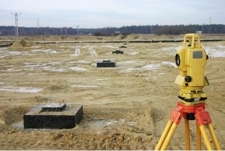
Aziz Infra Projects is the leading provider of Topographical Survey services in Kurnool and Nandyal, Andhra Pradesh. We create detailed contour maps with spot levels, L-section and C-section for roads, canals, dams, townships and infrastructure projects using Total Station, DGPS and Drone Survey technology.
What is Topographical Survey?
Topographical Survey is the process of measuring and mapping the 3D features of a land surface including natural and man-made features. It shows elevation, contours, slope, trees, buildings, roads, and utilities. This survey is essential before starting any construction, road, irrigation or township project for proper planning and design.
Our Topographical Survey Services
- Contour Mapping: Detailed contour map with 0.5m / 1m interval for site planning and drainage design.
- Spot Level Survey: Elevation points for road, building and infrastructure projects in Kurnool & Nandyal.
- L-Section & C-Section: Longitudinal and Cross section survey for roads, canals, pipelines and railway lines.
- Feature Survey: Mapping of trees, buildings, poles, drains, culverts and existing utilities.
- Volume & Cut-Fill Calculation: Earthwork estimation for site leveling, mining and reservoir projects.
- Drone Topographical Survey: Large area mapping up to 500 acres with high resolution orthophoto and DEM.
- As-Built Topo Survey: Documentation of completed projects for govt submission.
Deliverables You Get
- 📄 AutoCAD Drawing: .dwg file with contours, spot levels and features
- 📊 PDF Report: Contour map with index and legend
- 📍 Excel Data: XYZ coordinates of all survey points
- 🖼️ Orthophoto: High-res aerial map for drone surveys
Why Topographical Survey with Aziz Infra Projects?
- ✅ High Accuracy: 2-3 cm vertical accuracy with Total Station & DGPS
- ✅ Fast Delivery: 24-48 hours for survey and AutoCAD drawings
- ✅ Latest Tech: Total Station, RTK DGPS, Drone for large areas
- ✅ Govt Standards: Reports as per MoRTH, Irrigation and Municipal norms
- ✅ Experienced Team: 10+ years in AP govt and private projects
Applications of Topo Survey
We provide Topographical Survey for Road Projects, Canal & Irrigation, Dam & Reservoir, Township Layout, Industrial Land, Solar Park, Mining and infrastructure development in Andhra Pradesh.
Areas We Cover
Topographical Survey services available in Kurnool, Nandyal, Adoni, Dhone, Orvakal, Yemmiganur, Banaganapalle and all districts of Rayalaseema. Site mobilization within 24 hours.
Get Your Contour Map Today
Need accurate contour and L-section survey? Contact Aziz Infra Projects for best Topographical Survey rates in Kurnool & Nandyal. Call +91-9849786777 or email azizinfraprojects@gmail.com