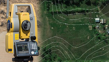

Contour Mapping
Contour mapping is the process of representing the three-dimensional features of a terrain on a two-dimensional map using contour lines.A contour map displays lines of equal elevation, known as contour lines, to represent the topography of an area. Each line indicates a specific elevation, helping to visualize the shape and elevation of the land.Contour maps are used to show the elevation and shape of the land, aiding in understanding the terrain's relief and slope. They are essential in fields such as geology, engineering, environmental studies, and urban planning
Shop No 50 3rd Floor Skanda Shopping Mall Old Chand Theater Kurnool - 518001
Email us : azizinfraprojects@gmail.com
Call us on : +919849786777